Yorkshire Dales and Malhamdale
The Yorkshire Dales National Park is famous for wonderful scenery, historic sites, and unspoilt tranquillity. With deep valleys, known as dales, roads meandering between drystone walls and a patchwork of hay meadows and field barns. Up above is heather moorland and distinctive hills, such as the much loved Three Peaks. There is the Settle to Carlisle railway which cuts through the National Park using tunnels and viaducts, including the iconic Ribblehead.
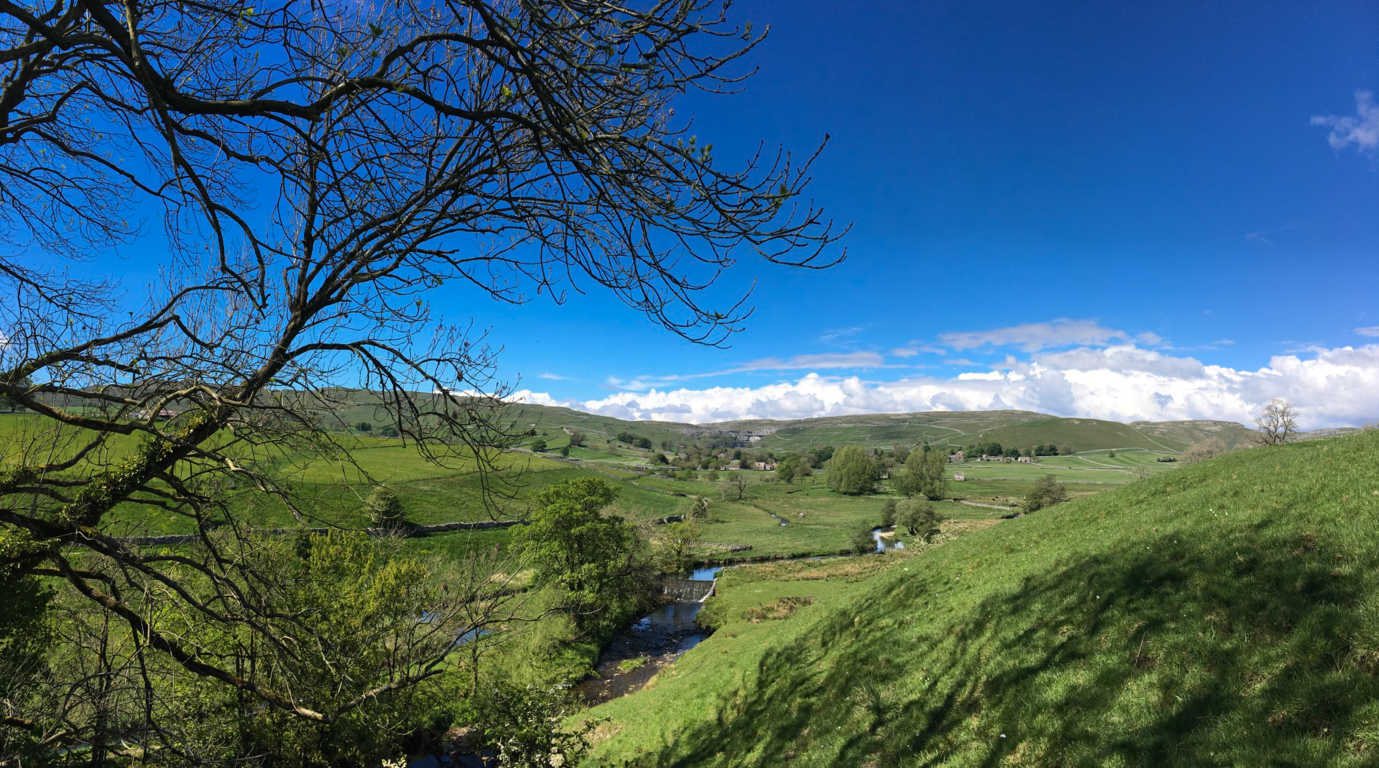
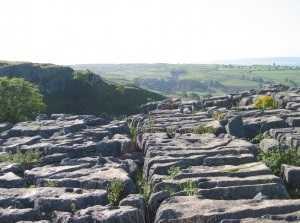
Malham is a small village at the southern end of the Yorkshire Dales. It's a pretty place, surrounded by limestone dry-stone walls, and with a stream running right through the middle of the village. Just north of the village is Malham Cove, a huge curving cliff formation of limestone rock created by an ancient waterfall. The vertical face of the cliff is 260 feet high and the top of the cove is a large area of deeply eroded limestone pavement, of a strange pattern rarely seen in England. The majesty of Malham Cove looks out over the village of Malham and has been attracting visitors for centuries. For climbers, it is a grand amphitheatre with some of the hardest sport climbs in the country. Malham is popular all year round with climbers and walkers alike. The Cove is also a Site of Special Scientific Interest (SSSI), so special care should be taken when visiting.
More recently Malham Cove has also starred in the Harry Potter film Deathly Hallows, so there's certainly something magic about this place. Nearby, Gordale Scar is a spectacular gorge, complete with waterfalls cutting right into the limestone hillside. The gorge was produced by water from melting glaciers sometime over the last three million years. Gordale Scar is one of the highlights of a visit to Malham.
The village of Malham has plenty of choices for accommodation and makes for a great location to tour the area on foot. One of my favourite walks takes in Malham Cove, the pavement above, and then a walk through unspoilt scenery past historic limestone caves, and finally arriving in the delightful market town of Settle. Malham to Settle Walk - By Keith Oxby Beginning in Malham village we head north towards the Cove but bear right at the bridge past the Lister Arms. Just after the pub, turn left between cottages and follow the Pennine Way footpath uphill. After leaving woodland, we continue through a number of stiles, keeping Malham Beck on our left. You will begin to get a clear view of the Cove and look for the path to drop down to the left where a stone footbridge crosses the beck. After crossing the beck, turn right and continue following the stream to the base of the Cove, although be careful near the Cove, because the rocks are slippery. Having taken in the sight of the Cove reaching up above you, backtrack to where the path branches off to the right, and a series of steps ascends to the top of the Cove. A steady climb will take you up with increasing views behind you of Malhamdale and the village. Once you reach the top, take a breather and explore the pavement, but be very careful if the limestone is wet, because the grikes (cracks in the pavement) are real leg breakers. Beware also of getting too close to the edge of the Cove because every few years an overeager sightseeing photographer falls to their death from the top.
After leaving pavement, take the path back past where you came up, keeping the wall and Malhamdale on your left. The path will curve to the right and pass over two stiles. Just after the second stile turn left and follow an indistinct path close to the wall, up the hill and through a gate onto Cove Road. You are on Common Right Of Way land (CROW) so don’t be concerned if your map doesn’t show a path. On Cove Road turn left downhill to a stile a hundred yards down on your right. Over the stile and follow the track uphill through Fair Sheets Gate to join the Dales High Way/Pennine Bridleway and keeping straight on. Continuing along the Dales HW you will pass Stockdale Farm on a single-track road and then bear right through a stile to re-join the Dales HW.
A final rise on a grassy section of path will bring you to a view over the Ribble Valley and the town of Settle. Follow the path descending and bearing left, to enter the town and eventually the town square. Across the road is the Naked Man Café where a coffee and cake await you, or maybe a pint in one of the pubs. There are buses to Malham, but the best way back to your car or accommodations is local taxi. Length of walk 7 miles. |
 (Medium).JPG)
.jpg)
 (Medium).JPG)
.jpg)